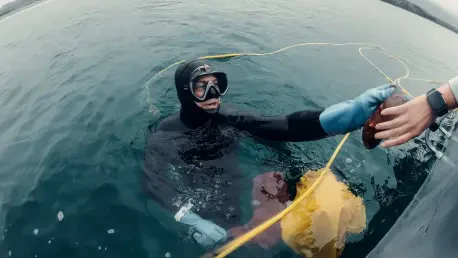

Bridging the gap between raw marine data and environmental policy requires a sophisticated understanding of how spatial scales influence the behavior of diverse fish communities. Dr. Alexander Ilich’s journey into the depths of oceanography began not in a formal classroom, but on the local docks where he spent much of his childhood exploring the waterfront. By using simple nets and traps to investigate the hidden life beneath the surface, he developed a foundational curiosity about marine biology that would eventually evolve into a rigorous and highly successful professional career. This early, visceral connection to the water provided the psychological spark necessary to pursue the complex academic challenges of marine resource assessment. Today, as a postdoctoral researcher at the University of South Florida’s College of Marine Science, Dr. Ilich has successfully transitioned from an inquisitive childhood observer to a leading expert in the field of seafloor mapping. His current work transforms those early passions into a systematic scientific methodology that helps redefine how we understand and manage underwater ecosystems.
The transition from a student to a professional researcher involved a dedicated commitment to understanding the intersection of technology and marine ecology. Dr. Ilich’s primary focus during his graduate studies centered on how the physical characteristics of the seafloor dictate the distribution and health of various fish populations. By working in the specialized lab of Dr. Steve Murawski, a renowned figure in the field, he was able to apply advanced theoretical concepts to real-world environmental problems. This academic evolution was marked by a strategic focus on spatial scales, recognizing that the data collected at a micro-level must be correctly interpreted to be relevant for large-scale environmental management. His transition into a postdoctoral role within the Center for Ocean Mapping and Innovative Technology reflects a career trajectory built on the consistent application of high-tech solutions to longstanding ecological questions.
From Academic Foundations to Technological Mastery
The Evolution: From Student to Doctoral Expert
During his tenure at the University of South Florida, Dr. Ilich’s academic trajectory was defined by a prolific output of research and a strategic focus on the intersection of technology and ecology. Working within the lab of Dr. Steve Murawski, he progressed through Master’s and Ph.D. programs that emphasized the critical importance of spatial scales in marine environments. His doctoral research was particularly successful, resulting in six first-author publications and four co-authored works that contributed significantly to the existing body of oceanographic knowledge. These achievements were further recognized through prestigious accolades, such as the William and Elsie Knight Endowed Fellowship Fund for Marine Science, which supported his efforts to bridge the gap between academic theory and practical application. His work consistently demonstrated that a deep understanding of habitat complexity is essential for accurate fish population modeling.
The complexity of his research required a move beyond traditional sampling methods, pushing him to explore how high-resolution mapping could improve our understanding of the Gulf of Mexico. By focusing on the relationship between seafloor topography and biological diversity, he provided new insights into how specific species utilize their environments. This period of his career was not just about data collection, but about developing the expertise necessary to lead large-scale research initiatives. The multidisciplinary nature of his training allowed him to integrate biological observations with geological data, creating a more holistic view of marine ecosystems. This foundation in doctoral research set the stage for his current initiatives, where he continues to apply these sophisticated methodologies to solve pressing environmental challenges through the use of advanced spatial analysis and remote sensing technologies.
Technical Synergy: Integrating Sonar and Visual Data
The core of the methodology employed by Dr. Ilich involves the synthesis of two primary high-tech tools: multibeam sonar and underwater camera systems. The sonar technology, which is mounted beneath research vessels, functions much like a medical ultrasound by using sound waves to generate high-resolution images of expansive seafloor territories. This allows researchers to visualize underwater landscapes that are otherwise inaccessible, providing a clear picture of the physical structures that define marine habitats. However, sonar data alone cannot provide a complete ecological picture, as it lacks the ability to identify specific biological inhabitants. To address this limitation, Dr. Ilich utilizes underwater cameras to provide visual verification for the sonar data. This “ground-truth” approach ensures that the physical maps are accurately paired with the specific fish species and biological communities present in those areas.
By integrating these two distinct data sources, his research produces comprehensive habitat maps and precise estimates of fish abundance. This methodology allows scientists to track how fish communities change over time and differ across various geographic locations with unprecedented accuracy. The ability to see exactly what species are occupying a specific underwater ridge or valley provides the missing link between physical geography and biological health. This technical synergy is particularly valuable for identifying essential fish habitats that require special protection or management interventions. Furthermore, the use of these integrated systems allows for the rapid mapping of large areas, which is essential for monitoring the vast and often changing environments of the Gulf of Mexico. This approach has become a standard in the field, illustrating how the combination of sound and sight can revolutionize our understanding of the ocean floor.
Strategic Collaboration and Open Science
Regional Advantages: The Power of Institutional Location
The professional success achieved by Dr. Ilich is deeply tied to the strategic advantages provided by the University of South Florida’s College of Marine Science in St. Petersburg. The campus serves as a central hub for marine research, situated in close proximity to major regulatory and scientific agencies like the Florida Fish and Wildlife Conservation Commission and the National Oceanic and Atmospheric Administration. This geographic advantage allowed him to move beyond purely theoretical studies by facilitating direct collaboration with government scientists and environmental managers. Being part of this unique “research ecosystem” meant that his work was always grounded in real-world management needs, ensuring that his findings were directly applicable to the challenges faced by local and national policymakers. This environment fostered a culture of networking and mentorship that is often difficult to find in more isolated academic settings.
The proximity to these agencies also provided unique opportunities for hands-on experience and professional development that extended well beyond the lab. By interacting regularly with scientists from the U.S. Geological Survey and other federal organizations, Dr. Ilich was able to align his research goals with the broader objectives of the scientific community. This collaborative atmosphere ensured that his doctoral work was not conducted in a vacuum but was part of a larger effort to protect and manage marine resources. The networking opportunities available in St. Petersburg also allowed him to build a global network of collaborators, which was further enhanced by travel scholarships to attend international conferences. This strategic choice of location proved to be a decisive factor in his ability to produce impactful research that resonates with both academic and regulatory audiences across the marine science landscape.
Digital Democratization: Promoting Transparency Through Open Science
A defining characteristic of the professional philosophy held by Dr. Ilich is a deep-seated commitment to the principles of open science. Throughout his research career, he has developed two open-source software packages specifically designed to make complex scientific methods more accessible and reproducible for researchers across the globe. By sharing these tools, he fosters a collaborative global environment where long-term datasets can be utilized to understand ecosystem functions more transparently. The goal of this initiative is to lower the barrier to entry for other scientists, allowing them to utilize advanced mapping techniques without the need for proprietary and often expensive software. This commitment to transparency ensures that scientific findings can be independently verified, which is a cornerstone of robust environmental policy and management.
This shift toward open science reflects a broader trend in modern oceanography, where the focus is moving toward collaborative research that leverages large-scale, shared data. Dr. Ilich’s efforts to democratize scientific tools have enabled researchers in resource-limited settings to perform high-level habitat mapping and population analysis. This approach not only accelerates the pace of scientific discovery but also ensures that the management of global marine resources is based on the best available data and methods. By providing the scientific community with these tools, he has helped create a more interconnected and efficient research landscape. This dedication to transparency extends to the way data is presented and shared with the public and policymakers, ensuring that the insights gained from his research are used to inform sustainable management practices that benefit the entire marine science community and the ecosystems they study.
Innovative Solutions for Underwater Topography
Ecological Preservation: Science-Based Management for Sustainability
The primary objective of the research conducted by Dr. Ilich was to support science-based management of marine resources. The detailed habitat maps and fish population estimates generated through his work provided vital tools for policymakers who are tasked with protecting the biodiversity of the Gulf of Mexico. By offering a clearer picture of how fish communities changed over time, his research ensured that marine ecosystems were managed in a way that remained sustainable for future generations. This focus on actionable data meant that management decisions could be based on empirical evidence rather than estimates, leading to more effective conservation strategies. His work helped identify critical areas where fishing regulations or habitat restoration efforts would have the greatest impact, directly contributing to the long-term health of local fisheries.
The practical application of these scientific findings was a major milestone in the effort to bridge the gap between academia and environmental policy. For instance, the high-resolution maps produced during his postdoctoral work allowed managers to visualize the impact of environmental changes on specific habitats with greater clarity. This data was essential for developing strategies to mitigate the effects of climate change and other anthropogenic stressors on marine life. The collaborative nature of his research ensured that the tools developed were user-friendly for managers, facilitating a smoother transition from data collection to policy implementation. Ultimately, his contributions to marine science provided a robust framework for balancing the needs of the fishing industry with the necessity of preserving the natural beauty and biological diversity of the ocean’s most vital and vulnerable ecosystems.
Collaborative Mapping: Crowdsourcing Data and Navigational Safety
In his role at the Center for Ocean Mapping and Innovative Technology, Dr. Ilich explored the innovative frontier of crowdsourced bathymetry. This initiative equipped a fleet of recreational boaters in the Tampa Bay area with low-cost data loggers to record depth measurements during their routine activities. By aggregating this information from a large number of private vessels, the project aimed to create up-to-date seafloor maps that improved navigational safety and provided a more granular understanding of the bay’s underwater topography. This approach recognized that traditional research vessels cannot be everywhere at once, and that leveraging the activity of the local boating community could fill critical data gaps. The project successfully demonstrated that high-quality scientific data could be collected through community participation, making the process of mapping more efficient and inclusive.
The success of this crowdsourcing project provided a scalable model for other coastal areas looking to update their navigational charts and habitat maps. By involving the public in the scientific process, the initiative also raised awareness about the importance of marine conservation and the complexities of underwater geography. The data collected contributed to a better understanding of how sedimentation and other processes shifted the seafloor over time, which was crucial for maintaining safe maritime channels. Furthermore, the project showcased the potential for low-cost technology to complement expensive professional surveying equipment. This initiative proved that community-based science could deliver reliable results that benefit both the scientific community and the general public. The lessons learned from this project established a new standard for collaborative mapping, highlighting the value of innovative data collection methods in the modern era of marine research.